EMail
CoastalSafari@
CoastalSafari.com
Telephone
1-877-888-3020 (Toll free) or
709-579-3977
Mailing Address
50 Monkstown Rd. St. John's, Nfld. Canada. A1C 3T3
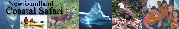
The abundance of icebergs along the Newfoundland coast depends on a complex interaction of winds and current. In 2000 it seemed in the early spring that there would be hundreds of icebergs along the shore in early summer. However winds blew the majority of icebergs out into the easterly branch of the Labrador current and almost all of them drifted out around the eastern side of the Grand Bank 200 miles from shore.
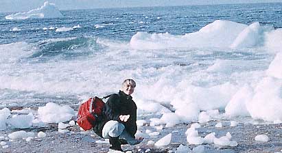
Clear of the shelter of the pack ice, icebergs are subject to erosion
from warmer temperatures and wave action. The icebergs seen along our coastline
normally range up to one million tonnes although even 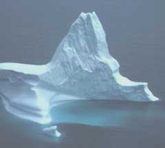 bigger icebergs are sighted occasionally. It is not unusual for icebergs
to run aground and then slowly melt away as the summer progresses. A fascinating
micro ecosystem of plankton, fishes and birds thrives in the freshwater
of melting icebergs.
bigger icebergs are sighted occasionally. It is not unusual for icebergs
to run aground and then slowly melt away as the summer progresses. A fascinating
micro ecosystem of plankton, fishes and birds thrives in the freshwater
of melting icebergs.
The Titanic disaster brought icebergs to world attention as a hazard to shipping. As a result the United States Coastguard started the International Ice Patrol which continues today. The iceberg season with daily updates of the southern limits of icebergs and a map started on March 1 2001. The map shows the edge of the sea ice, which is frozen sea water, and the southern extent of icebergs. There are always many icebergs within the sea ice. Icebergs that are south of the sea ice edge are shown as triangles. Targets that have been identified by radar but not confirmed as icebergs are shown as circles with a cross inside.
The most southerly extent of the sea ice and the maximum concentration of icebergs is the middle of April after which the sea ice starts its northward retreat.
A good source of links to iceberg information is found at the
Canadian Ice Service
. In recent years the development of an offshore oil industry off Newfoundland
and Labrador has made iceberg detection and towing into an industry
as oil platforms operate in the area the oil companies have christened Iceberg
Alley. For more information see the Hibernia
and Terra Nova
websites.